Thursday, March 31, 2011

Independence Peak

Yesterday my coworker, Brian, joined me for a tour up Onion Valley way.

Currently you can drive the road for about a half mile beyond the first hairpin where the old mining road to Sardine Canyon is. The county is working on clearing the road beyond the closure, so they do not want folks parking above that. The county does not work up there Saturday, Sunday or Monday.

After a 15 to 20 minute hike on the road we were on the skis and enjoying a real nice sunrise.
We headed up the main chute on the northwest side of Independence Peak, which was filled with an impressive amount of avalanche debris.

This is the upper part of the chute. The old avalanche crown line can be seen on the side of the gully in the sun (click to enlarge).
We found some decent settled, sugar snow in the protected north facing trees, so we headed up a short slope to the ridge bordering Lime Canyon. We enjoyed fine views there.
Yep, that's me! Gee, I thought I was smiling.
The soft snow here skied pretty well.

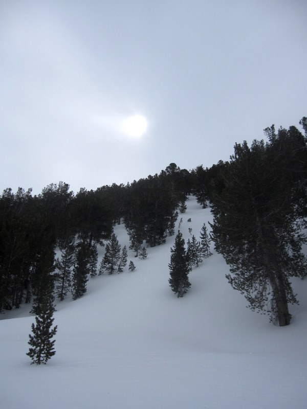
We then traversed out into the beautiful old growth pine grove and made a few turns on softening slightly cooked powder. Much later and it would have been mush.

We then popped into a short gully. More wet snow - we did not start those pinwheels.
Nice little line, not corn yet, but our timing was good so it skied ok.
Actually found very nice corn out beyond the mouth of the chute on south east aspects.

Back to the car by 9:30.
Perfect way to start a work day!

Saturday, March 26, 2011

South of Habeggar's

Since we worked so hard yesterday to put in the skin track, we figured using it again today would be wise.

DK on the skin track.
Skied down a nice chute west of the glades. Ran into a little wind crust/pack and some sun crust too, but enjoyed the terrain a lot.

Headed back up for another. Getting pretty tracked up!
Winds were on the increase - even in the trees.
Still lots of nice snow in the sheltered areas.
4500'. 5.5 hrs. Uncountable smiles!

Friday, March 25, 2011

Time to Catch Up!

Last weekend Nemo and I went up above Lake Sabrina to the glades leading up toward George Lake. We found some decent skiing in the protected trees.
Spied a few nice lines.

Enjoyed some fine big mountain scenery too.

Took a midweek tour back to Lime Canyon.
Found some real nice snow amongst the Pinyons.
Rugged terrain beckoned, but since I was solo, I stuck to meadow skipping.
Meadows, skipped!Today Nemo and I hooked up with Dave King and skied some nice trees out of the South Fork of Bishop Creek.

With all the recent snow, the trailbreaking was hard work.

The rewards were great however.

This guy is pushing 70 years old and still gets out as much, if not more, than anyone else around here.

Still knows how to have a good time too.
Super snow, bluebird day, cold temps.
Yeah, it was another good day.

Thursday, March 17, 2011

Habeggar's South

Went for an quick early morning tour out of Habeggar's (South Fork Bishop Creek) with my friends Nemo and Brian.

Had planned on skiing corn in Maggot Bowl, but clouds were hanging over the crest and the winds seemed strong over there, so we looked for old, soft powder in the trees.

We skinned up the steep gully just south of the Habeggar glades to the top of a small knob with nice views.

Found very small pockets of soft snow, but almost everything was sun affected.
Fortunately the sun affected snow was generally supportable, so it was kinda skiable.

Popped into Habeggar's proper and out the old road - which had several dry spots.

Despite the rather poor conditions everyone had fun.

The South Fork road appears to be plowed.
I heard that it's one, narrow lane all the way to the dam, but not sure of that.
Looks like they are trying to keep traffic out for now with a heavy steel sign blocking entry.
Could be a good time for a bike and ski if you are so inclined!

Monday, March 14, 2011

Birch Creek Area

Saturday I got a bit more ambitious and dragged my friends Anne, Simon and Darren up above the Birch Creek trail head near Big Pine.

Wispy high clouds made for some nice light early on.
Darren and Anne head up with Birch Mtn behind.
The Thumb is a splendid ski, but not on today's itinerary.
Nemo makes his way ever higher with the North Face of Birch behind.
Anne skins up one of the many huge snow fields.
Unnamed but not unnoticed.
Darren boots up with Birch behind.
The cloud shield dissipated by late morning, but the winds remained steady, especially above 9000'.

Enthusiasm waned, so we headed down.

Firm, but smooth snow higher up gradually transitioned to smooth soft snow as we descended.
Smiles widened.
This is the view from the trail head with Birch Mtn on the left and the Thumb distant center.
It is still a fairly short hike (10-15 mins) from the trail head to snow and should remain until the next prolonged heat spell - whenever that may be.

Last Friday in Aspendel

Last Friday Mary, Dori and I headed up out of Aspendel hoping to skin up towards Bishop Bowl, have a look around, and then either ski back down our ascent route or drop into North Lake.

The normal route up the moraine towards Bishop Bowl is getting a little thin, which made for some interesting skinning.

Mary perfected her bush kick turn.
Mary happily emerges from the Mountain Mahogany.
Nice views of Mt Tom greeted us from the top of the moraine.
Owing to poor skinning conditions (firm windboard) and rapid warming, we turned around and skied our ascent route. The snow was a tad on the thick side even at 11am, but provided reasonably good skiing as Mary demonstrates.
Dori teles the lower part of the moraine where we found the best snow.
Thirst quenching beers were had, and much appreciated, at the car.

Wednesday, March 9, 2011

Hogback Creek

I had not planned on skiing today, but I went to bed pretty early, woke up really early, so I figured why not?

The Hogback drainage is the next major drainage north of Lone Pine Creek (Whitney Portal).

It is seldom visited since it does not lead to any passes, is not a good route to any peaks, and has no sizeable lakes for fishing. Yet it is a fantastic place with rugged gorges, towering cliffs, and huge vertical relief.

This is one of the several fine gully systems in the drainage.
The road to the mouth of the canyon is currently passable almost to its end. After the road end it is imperative to attain a small ridge which divides the south fork from the main stem of Hogback Creek.

After 40 minutes or so of hiking - which was largely pleasant with a little postholing and bushwhacking - it was time to ski.

Skinned for 20 minutes or so in this kind of terrain.
Before things opened up.

The south fork drainage.
The rugged gorge of the north fork.
I reached my high point, a nice saddle at around 9250', and enjoyed these views.

This sweet little corn run skied very nicely
This is probably the worst section of the ridge hike.
Back to the truck in three hours plus!
A great adventure.

Hogback is truly an amazing place.
I hope to come back soon with more time.

Seems like the corn skiing on the south to southeast aspects is real nice right now. Even skis well before it softens. Sunny aspects were plenty fun even at 8:30am!

Tuesday, March 8, 2011

Lime Canyon II

Got up Lime Canyon way for another early morning ski today.

Figured I'd show the last photo first to give an idea of what the whole route looks like. That's Independence Peak back right.
Nice views of the valley on the way up.
Contemplated taking this little detour on the way up, but opted for the main canyon instead.
Fine scenery up high.

Took my breakfast at my high point under this tree.

Skinning up I was not optimistic about the skiing on the way down, but I was surprised and more than a little pleased to find the corn skiing was excellent on all the south and southeast facing slopes. Nearly 4,000' of fun was had!