Friday, October 29, 2021

Early Season Skiing

The big storm rolled through early this week. The precipitation amounts were truly remarkable with several inches of water falling in the mountains. The temps, however, were warm and it was not clear how much snow fell at the differing elevations.

Hoping to find local action, I drove up Highway 168 above Bishop to the South Lake Road.

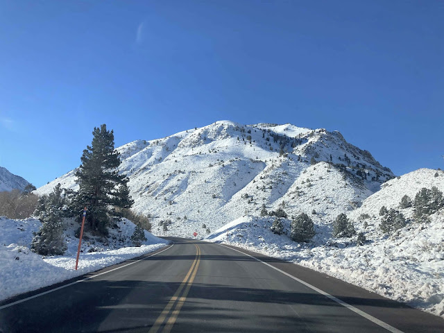
Table Mountain didn't look too bad at the very top, otherwise pretty poor.

The Inyo County road crew was plowing the South Lake Road above Habeggar's in order to remove a large rock in the road, so I switched my plan and headed over to the Aspendell/Sabrina side. The big peaks sure were looking fine.

Weird going on the road though. The pavement seemed to be warm/moist while the snow just above the pavement was cold, so the skis got super sticky anytime they got near the surface. It wasn't a big deal up near the North Lake turnoff where the snow was deeper, but a real downer lower. I even walked the last quarter mile!

On the drive back I stopped to admire Mt Tom, Wheeler Crest and the Tungsten Hills

Today I toured up to Red Cone. Didn't look too bad. Should have taken at least one run in there, but my exit route was looking sketchy and I was saving my legs for that.

Views along the crest.

Mammoth Mountain and Horseshoe Lake.

It was a real mix of skiing.

First of all, Lake Mary Road is rapidly melting out with big bare patches, ice, and vehicle tracks. There is only a few inches of snow.

Higher, near George Lake coverage improves depending on aspect, but most snow had some sort of sun effect. Even up on the rim of the cone, west facing snow was glazed and east facing snow was just starting to soften (9:00 am). 

The descent started with some truly nasty breakable melt/freeze crust. Staying in the skin track was the best bet although it was icy and fast.

Lower I found some SE facing slopes that held supportable crust that was just softening. Best skiing of the day.

I got into some shady north facing slopes that weren't too bad either except for all the tree drip that had refrozen. Open patches away from trees had soft, but heavy, faceted snow. Not too bad. Beneath the trees was best avoided although mostly supportable.

The exit actually went a lot easier than I expected. I took it real easy! Was happy to make to Mamie Lake without incident. BTW this was the only lake ice I saw. Twin, Mary and George were ice free.

Great to be on skis again. I had hoped for a little better skiing and a little more snow, but it's only October. Hope the storms keep coming!
 

Tuesday, October 19, 2021

Mendocino IV

Last days. I had to go for one more ride in the forest. The winds had really picked up overnight, but down in the canyon it was calm and serene.


We had booked kayak rentals for mid day. We gave it a go but found it too sketchy for our tastes. We had fun though, lots of laughs, one or two truly frightening moments, and some nice bird sightings.

We punted and went for a hike along the estuary where we tried kayaking.


This is Big River. Lives up to its name here.

The old haul road along Big River is a great spot for easy walking or riding. Wide, smooth and generally flat.

Took a stroll at the mouth of Big River on our last morning.


Wonderful!
 

Mendocino III

This day started with a nice long ride in the Big River area. I was super impressed with how much of the forest here was open to the public with a great network of trails and roads. The avid cyclist could spend days and days exploring here.

Early in the ride I found myself in this Pygmy forest. The soil here is very poor owing to iron and sand concreting into a hard pan. The trees and bushes are all stunted - and beautiful.

Most of the ride though was through gorgeous second and third growth forest.


After the ride we went for a stroll at the Spring Ranch Preserve, site of one the oldest ranches on California's north coast.

Barn shots.


A mellow stroll through wide open grasslands took us to the coast.


Next we took a pit stop in Fort Bragg before heading up the coast to Point Cabrillo.

These bright flowers were just about the only ones in bloom. They are not native, but quite showy!

At Point Cabrillo we stopped by Frolic Cove. It's named for a famous shipwreck. In 1850 the Frolic struck a reef near the point on the right. The ship's owner attempted to salvage the wreck, in vain, but discovered the redwood forests. He set about building a mill which contributed greatly to the building of San Francisco and the eventual eminence of the lumber industry here.

For some reason abalone pieces were in great abundance here.

For the most part access to the coast is easy. There are not long stretches of private land although a few spots like this exist where luxury mansions dot the bluffs.

The headlands here were not quite as dramatic as most other locales, but there was a fascinating moonscape like shelf below the shallow cliffs.

Freshwater seeps and springs emerge from the bluffs and flow across the shelf providing sustenance to this bright green algae.

The stately Point Cabrillo lighthouse, completed in 1909 is fully restored and functional.

To top off the day we stopped by Russian Gulch State Park. This is Devils Punchbowl, an incredible feature that was once a blowhole, then widened into a huge bowl.

More fine coastline. The folks in the kayaks were fishing.


 Good times.

Mendocino II

 Next day I started off with a short mountain bike ride through Fern Canyon at the Van Damme State Park. Despite the drought the canyon was green and lush. Peaceful too.

Mary and I planned out the rest of the day with a post ride cup of coffee on the deck.

We elected to explore the headlands right outside of the town of Mendocino.

The bluffs start right on the edge of town.


Logging ships moored to this rocky point while being loaded since there were no deep water ports nearby.

More amazing coastline.

We circled back into town, had a tasty lunch then walked north to catch more headland hiking which was even more spectacular.


The islands were thickly populated with Pelicans with a smattering of Gulls and Cormorants too.

Ice plant is an evil invasive, but stunning nonetheless.


The number of arches, bridges, and sea caves here is amazing.


 Loved it!

Saturday, October 16, 2021

Mendocino I

It has been over two years since we've last been to the coast. We were due! We chose the north coast area near Mendocino. Mary had never been there and I only breezed through a couple of times decades ago.

We arrived mid day and went straight to Jughandle Beach.

The weather was great, scenery sublime and it felt oh so good to breath the ocean air.

Beach sculpture.

After the beach stroll we climbed up onto the headlands.


Then finished the day relaxing at our rental - which was nothing short of amazing.

Next day we ventured up to Ten Mile Beach which is actually only four miles long, but sits below the mouth of Ten Mile River.


We poked around amongst the dunes. Most of the vegetation was parched except in the most low lying areas where the plants could reach down to groundwater.

This is Inglenook Fen, the southernmost of a series of fens running from Alaska southward. Fens are peatlands whose primary water source is groundwater. source. Much like oasis in the desert.

More dunes and vegetation.

After lunch we checked out Glass Beach.

The beach is named for the sea glass formed when residents of nearby Fort Bragg threw their trash into the cove.

A calm tidal pool elevated above the churning sea.

Evening at the Bauhaus (our rental) was sublime.


 Our first full day on the Mendocino coast ended on a high note for sure.