Friday, March 31, 2017

Huarte Creek

It's been a few years since I've been up the Huarte Creek drainage in Pine Creek Canyon. It was in fact the last big snow year, 2011 (click here for blog post). With lots of snow again this year I figured I would give it a go.

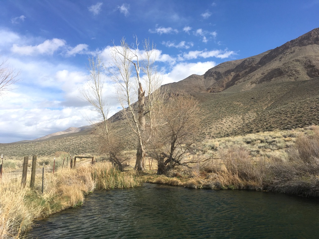
Probably should have done a little reconnaissance as Ben and I had to hike about 1500' just to get to snow.

 This is the couloir Anne and I skied back in 2011.

We took a left turn into a sub drainage that opens into a huge bowl.

Looking back towards Bishop from low in the bowl.

More big terrain!

We reached a saddle about 1000' below the Wheeler Crest.

With views of the impressive terrain around Broken Finger Peak (right).

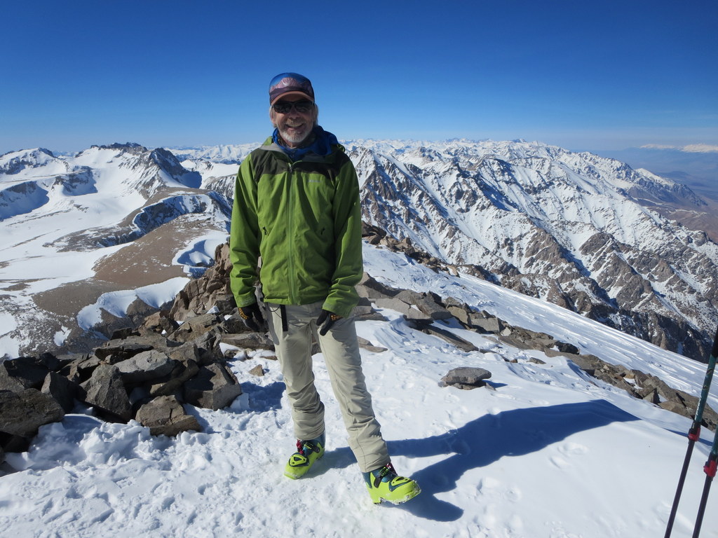
Ben soaks it in with Mt Tom to the right.

On the way up I started to feel a little peakish which grew into a sensation of nausea and strong fatigue once we reached the saddle. Time to head down!

The skiing was fair up high improving generally as we descended. We headed down around noon which was probably an hour or two late for ideal skiing here.

Despite my worsening condition I enjoyed the skiing.


But when we reached the end of the snow and began the long sage brush whack out I was pretty near my limit. Death march!

Turns out I had gastroenteritis compounded with dehydration requiring an ER visit later that evening. I felt like I'd been run over by a truck! Two liters of IV solution and some anti nausea meds got me back on my feet, but it took another 24 hours to feel human again. Ugh.

Waucoba Bay Mountain Bike

I've gotten a little behind due to illness (see next post) but catching up.

Tuesday I went for an exploratory mountain bike in the area known as the Waucoba Bay which is a gradually rising plain between the Inyo Mountains to the south and the White Mountains to the north.

The lower sections of road travel through old lake bed deposits which give the landscape a badlands appearance.


Didn't see many wildflowers, but did catch one of my favorites in full glory, Scarlet Locoweed.

 I followed a faint road high up the plain.  Looking back to where I was skiing last post!

Eventually descending back to the badlands.

Beautiful zone!

Sunday, March 26, 2017

Tinemaha Creek

Noticed a lot of snow in the upper reaches of Tinemaha Creek, so I got up early and checked it out.

Birch Mountain

Tinemaha Peak. I skied up the valley to the right.

Found a sweet ribbon of snow at around 6750'.


Winds & Clouds gathered

Wasn't too stoked about this view! I stayed high right on snow and descended to the far end of the forest. Went pretty smoothly.

Nice cloud formations.

Finally got a glimpse of my goal for the day. Windy!

The view down to the big valley.

Nice alpine scenery and wintery weather.


Turned around when the skinning became unpleasant. Probably another 400'+ to the top.

The upper slope skied well with a few inches of windblown new snow over a firm base. The rest of the run was quite good on perfectly cooked corn.

Been wanting to visit this zone for a long time.

Wednesday, March 22, 2017

Gravel Again

I took some time off to recover after feeling pretty beat last week. A small storm packing strong winds hit the mountains, so I elected to ride gravel in the valley.

Started off with a nice Bald Eagle sighting just a couple of miles into the ride. No good pictures though.

Black Mountain. 

The storm.

Cruised by the Radio Observatory.

Stopped for a bite at Warm Springs.


The riding was mostly good. A little rocky here and there, but plenty of this.

The Owens River flowing out its banks.

Might've been my last ride on the old gravel bike. Here's my new frame!

Might get a little more saddle time in this week before getting on skis again this weekend.
Felt good to feel good again!

Saturday, March 18, 2017

Mendenhall Couloir

I scooped up Ben and Ann early for another adventure in the mountains. This time we elected to ski the Mendenhall Couloir on Laurel Mountain above Convict Lake.

Unfortunately I managed to kick off a ski while performing a kick turn high on this slope during the approach. It slowly slid down about 500'. 

I had been feeling unusually tired and slow to begin with, so I downclimbed to the ski and bailed out while Ben and Ann carried on.

Here's the Mendenhall starting in the open bowl top center and funneling into a proper couloir lower.

I took a few pics during the day. Convict Canyon with Red Slate Mountain in the early sun.

The upper couloir.

The view across Convict of Mt Morrison (right) and min Morrison (left).

I returned to the car, changed my clothes, had a nice snack and plenty of water then settled in with the binoculars and watched Ben and Ann ski the couloir. It was a vicarious kind of fun.

The couloir is filled in nicely. B & A reported decent soft snow throughout. They primarily stuck to the northeast aspects which were holding winter snow, but excursions out onto sunnier slopes were ok too.  They did find some punchy snow down low - as did I on my descent.

For sure I was disappointed, but I'll be back to try it again. For now I need some rest and recuperation so I am good to go when the snow flies next week!


Monday, March 13, 2017

Mt Williamson Ski

For many years I've wanted to ski Mt Williamson, California's second highest peak at 14,379 feet. The trip is only reasonable in big snow years and even then the rugged approach and shear enormity has always seemed daunting. Fortunately my good friends Ann & Ben had the audacity to give it a go and invited me along.

We parked the truck just a touch below 6,000 feet, near the mouth of the North Fork of Bairs Creek and began to hike a bit after sunrise.

The first, and perhaps most important crux of the day was finding a notch that allows travel into the interior of the North Fork of Bairs Creek whose mouth is very steep and choked with willows.

This is the view of our route from the notch.

The next leg involved a decidedly unpleasant downward traverse on loose slopes to get down to the creek.

Finally down to the creek! We should have traversed higher and entered the canyon bottom another half mile or so upstream, but our route worked ok.

After a little more hiking we were on skis at about 7,400'. Here the creek forks and it's crucial to take the left turn here up the slope and ridge above Ben's head.

At around 9200 feet the valley opened up and travel became easy.

Big country!


After a nice spell of skinning we reached the base of the headwall couloir.

The previous party had put in a good bootpack, but an ice axe and crampons were still handy for piece of mind. Ann boots it!

The second big crux of the day behind us, Ben was all smiles!

Then we headed off for the summit (out of view upper left).


Ann arrives at the summit!

Of course the views were stupendous.

Mt Whitney

The Kaweah Range across the upper Kern River gorge.

Mt Tyndall

The Owens Valley 10,000 feet below.

Ben & Ann. Pretty darn happy.

So was I!

Ann took this nice pic of me leaving the summit.


The ski down was a real smogasbord of snow surfaces providing generally fair to poor skiing with shorter sections of fun powder and horrible punchy snow. 

Ben finds some decent skiing on solid windboard.

This little waterfall slowed our progress a bit.

Ben and I at the notch on the way down. Almost there!

We arrived back at the truck as the day got dark and the moon rose, tired but not shattered. Elated for sure. Thanks so much Ben and Ann!