I had the good fortune to be invited along on a reconnaissance flight by my friend Ann and her ski partner Matt who are planning on doing the Red Line traverse of the Sierra.
I have actually flown in this plane before after our second trans Sierra ski tour click here.

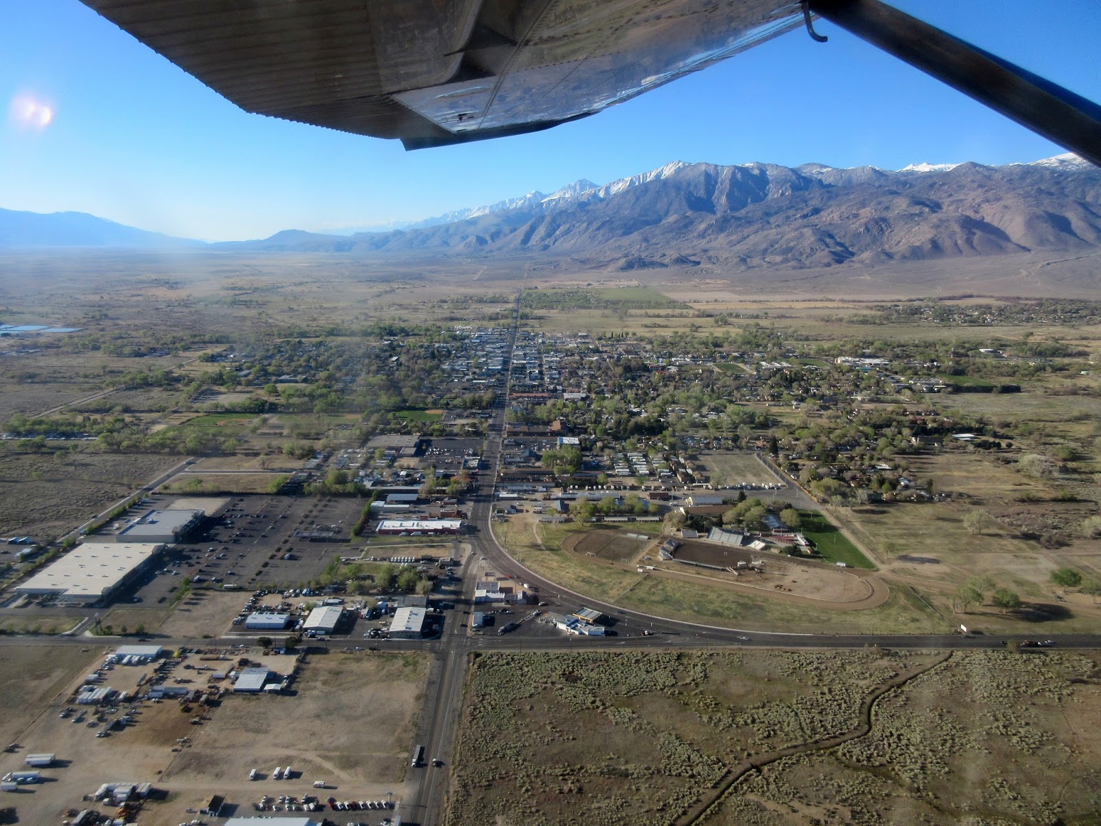
My little town.
We gained altitude over the Buttermilks and cruised up and over Bishop Pass. Mt Aggasiz on the left and Mt Winchell on the right.

Looking back to Bishop Pass where the shadows from the Palisades end.

A bit further south Mt Sill is the large triangular peak, Scimitar Pass is the snow ramp lower left.

Desperately thin snow on Birch Mountain with the Owens Valley behind.

Split Mountain.

Looking west from the vicinity of Taboose Pass to Bench Lake and Arrow Peak on the left.

The impressive east face of Mt Tyndall.

and the giant hulk of nearby Mt Williamson.

Mt Whitney

The giant granite faces on the south side of Lone Pine Peak.

Mt Langley and the long couloir on its north east flank.

Looking east to Lone Pine Peak, and Mts Mallory, Irvine, McAdie, LeConte, Corcoran and Langley.

The Kern River Canyon in the foreground and the Kaweahs in the back.

Looking west to the northern end of the Great Western Divide.

The amazing Mt Brewer appears to hold a couple of skiable routes.

The rugged Kings Kern divide.

The classic couloir on Deerhorn Mountain.

A closer shot of Arrow Peak

The route of our first trans Sierra tour, the Monarch Divide, with Frozen Lake Pass in the low foreground and the Cirque Crest running out to the skyline.

Mt Goddard looks like a splendid ski mountain.

The huge snowy expanse of the Humphreys Basin with the Humphreys massif on the right.

Paiute Crags. All melted out!

Wonder Lakes on the left and Piute Pass on the right.

Back home.

Amazing and inspiring!!!
Thanks Ann.
1 comment:
I totally saw you fly over me at South Lake around 7:30-8am coming from the north.
Post a Comment